
Sensors / External devices#
Sensors#
Found in Configuration window, the sensors menu shows the different devices that can communicate with Air Navigation Pro. These sources provide positioning, navigation, and flight-related data. Sensors are grouped into four main types:
Internal: Built-in sensors of the device (e.g., GPS and barometer). These provide position, altitude, heading, and speed information directly from your device.
External: Third-party hardware connected via Bluetooth, Wi-Fi, or cable (e.g., external GPS receivers, ADS-B devices).
Simulator: Data sources from flight simulators (e.g., X-Plane, Microsoft Flight Simulator, or other compatible programs). This allows Air Navigation Pro to be used for training and practice in simulated flight environments.
Misc: Other data sources that don’t fall into the above categories (e.g., special integrations).
Internal Sources#
These are the built-in sensors and services available on your platform (such as GPS, barometer, or compass) that Air Navigation Pro uses to provide navigation and flight information:
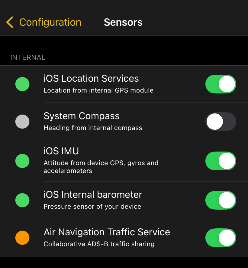
Location Services - Provides position, speed, and altitude data using the device’s internal GPS.
System Compass - Supplies magnetic heading information from the device’s digital compass, exclusively available on iOS devices.
iOS IMU (Inertial Measurement Unit) - Delivers attitude, acceleration, and gyroscopic data.
iOS Internal Barometer - Starting with the iPhone 6 and Ipad Air 2, the devices are equipped with a barometer. Air Navigation Pro leverages this barometer to better understand the location of the aircraft and show even more accurate data.
Air Navigation Traffic Services - Collaborative traffic sharing. This service will push your current position together with the traffic received by your ADS-B or FLARM device to our server. You will be provided with Traffic information sent by other Air Navigation users.
Note
The type and accuracy of data may vary depending on your device’s hardware and operating system.
External Sources#
These are additional devices connected to Air Navigation Pro that provide enhanced navigation and flight data:
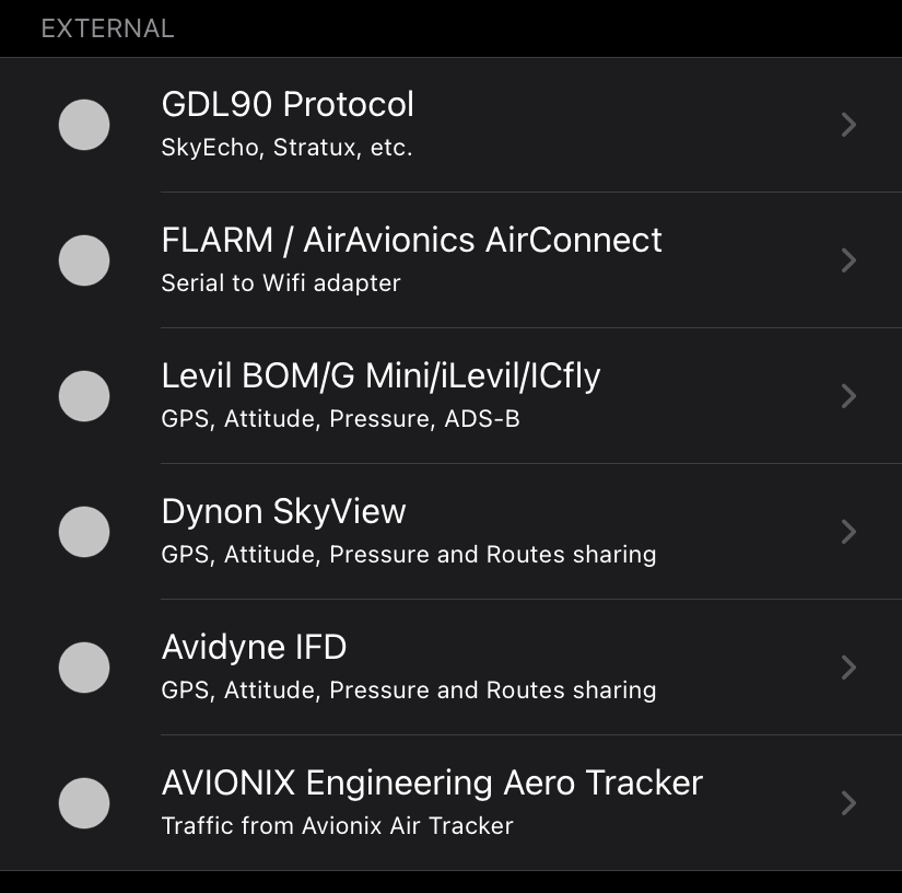
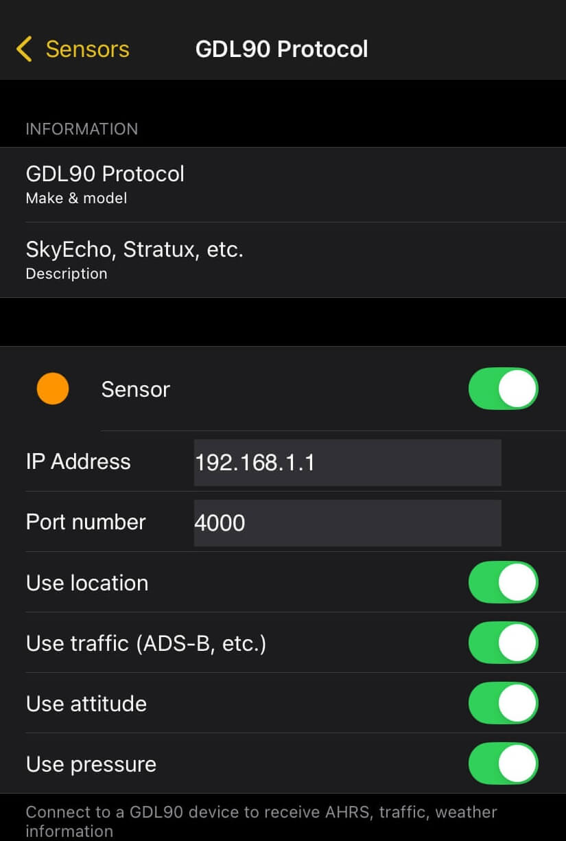
GDL90 Protocol: Connects to the application installed in your device that transmit traffic information in GDL90 format e.g. Safesky, AvTraffic or Flying Neurons.
FLARM / AirAvionics AirConnect: Enable when connected to a FLARM | ADS-B receiver through the AirConnect interface system from AirAvionics. Besides traffic information, it will also provide location information. A PIN code may be needed for AirConnect’s older versions (serial number starting with B104).
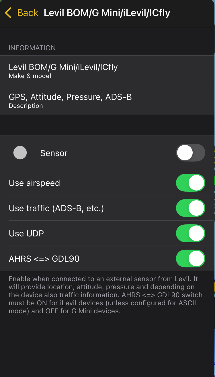
Levil BOM/G Mini/iLevil/ICfly: Enable when connected to an external sensor from Levil. It will provide location, attitude, pressure and depending on the device also traffic information. AHRS <=> GDL90 switch must be ON for iLevil devices (unless configured for ASCil mode) and OFF for G Mini devices.
Dynon SkyView and Avidyne IFD: Air Navigation Pro can connect to avionics system such as these sensors to retrieve your position. It also supports route exchange between Air Navigation Pro and connected avionics systems.
AVIONIX Engineering Aero Tracker: Connect to Aero Tracker ADS-B and Safesky enabled box via Bluetooth. Will retrieve and display traffic on the map and provide nearby traffic alerts
Hint
When activating a sensor that provides multiple sources such as Levil BOM/G Mini/iLevil/ICfly for location, it will automatically activate sensor sources for attitude, pressure, and traffic, not just for the location.
Note
Other External GPS receivers like the ones from the Bad-Elf, Garmin or Dual will use this sensor. On Android, you will need an application to mock the GPS location from the Bluetooth receiver. See instructions here.
Simulator and Misc#
This feature is useful for training, testing, or demonstrating Air Navigation Pro’s functions. You can set your own position, speed, altitude, and heading to see how the app behaves in flight conditions.
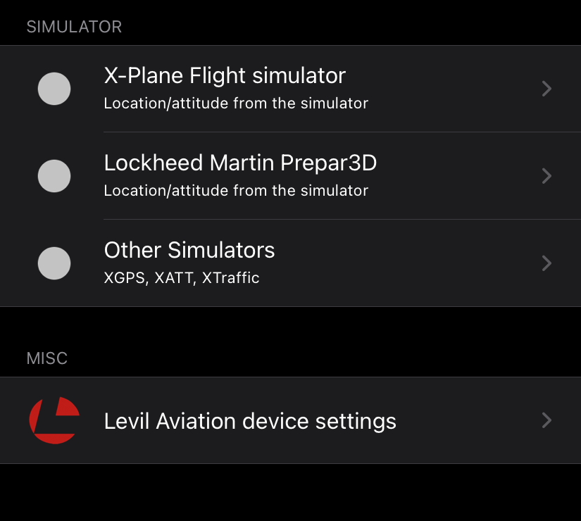
X-Plane Flight simulator: Provides position, attitude, and flight data directly from X-Plane for training and testing. For setup, ref to Connecting to X-Plane.
Lockheed Martin Prepar3D: Delivers realistic flight data integration from the Prepar3D simulator. Ref to Connecting to Lockheed Martin Prepar3D
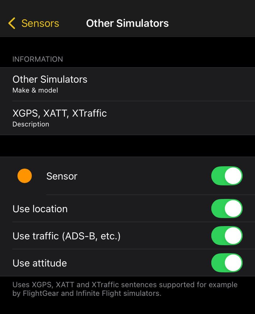
Other Simulators: Uses XGPS, XATT and XTraffic sentences supported for example by FlightGear and Infinite Flight simulators.
Levil Aviation device settings: This section allows you to configure and manage Levil Aviation wireless devices such as the BOM, G Mini, iLevil, or iLevil3. These devices provide GPS, AHRS (Attitude and Heading Reference System), and pressure data to enhance flight information and situational awareness. Make sure your device is properly connected via Wi-Fi and recognized by the app to ensure accurate data transmission.
External Device Setup#
External GPS antennas#
No matter if it is wired or Bluetooth, the procedure to make sure the device is working is the following:
Create a connection between the iPad/iPhone and the external GPS device.
Make sure to have Air Navigation Pro activated under Location Services in the Settings > Privacy of the device.
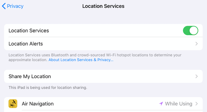
Location Services is on when using the Air Navigation Pro
Location Service GPS sensor is on in the Air Navigation Pro
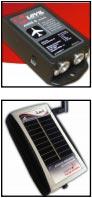
Levil Products#
AHRS#
Air Navigation Pro is prepared to work with the external device known as AHRS from Levil technology. It’s compatible with its two versions:
AHRS G Mini - Attitude, Pressure, Airspeed, UDP connection, AHRS, Traffic (ADS-B, etc..)
iLevil - Attitude, GPS, Pressure, Airspeed, UDP connection, AHRS, Traffic (ADS-B, etc..)
BOM AHRS - Attitude, GPS, Pressure, Airspeed, UDP connection, AHRS, Traffic (ADS-B, etc..)
The AHRS will provide accurate data for altitude, bank and rudder. Besides it shares pressure, altitude and airspeed information with Air Navigation if the sensors are active.
How to connect the iLevil#
On the toolbar, tap Tools (For phone: Tap Config.) > Sensors > Levil BOM/G Mini/iLevil/lCfly
Enable the Levil sensor
Switch on the iLevil device, wait calibration, then connect the iPad/iPhone to the device wifi network.