
Drawers#
The Drawers are a quick access to key information regarding your offline routes/waypoints, status of the sensor used or device storage space, aircraft information and departure/arrival waypoint.
Tapping on the drawers will open up a tab of information related to your flight. To close the tab just tap anywhere on the map.
(For the Screenshot Matt pls point/highlight the Dock and create labels 1. SmartChart downloads 2. Resolution Centre 3. ATC 4. Departure waypoint 5. Arrival waypoint - Ask Matt)
SmartChart downloads#
The routes and waypoints added to the SmartChart downloads are stored in the mobile device and can be used without internet connection.
Add route to the SmartChart downloads#
On the Menu bar, (for phone: tap “…” ) select Route menu
Select a route to add by tapping “…” at the right side of the route
Select Download SmartChart
Tap OK.
Note: When the  icon is displayed at the right side of the
route it means that the route is not added to the SmartChart downloads
and when the
icon is displayed at the right side of the
route it means that the route is not added to the SmartChart downloads
and when the  icon is displayed means that it is already added
to the SmartChart downloads.
icon is displayed means that it is already added
to the SmartChart downloads.
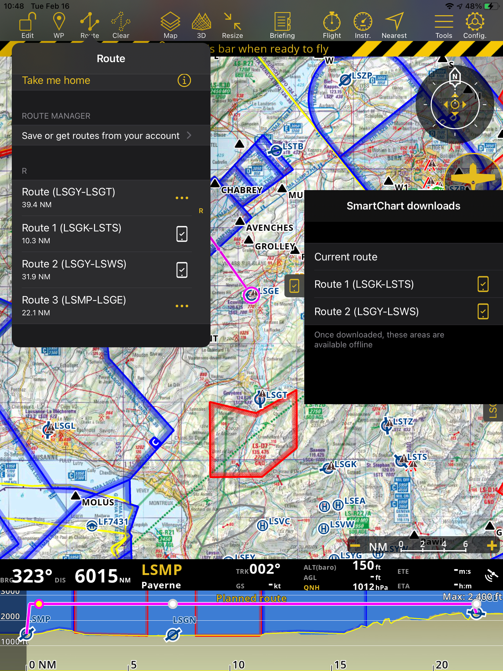
Example: In the SmartChart drawer the Route 1 (LSGK-LSTS) and Route 2 (LSGY - LSWS) are downloaded.
Add waypoint to the SmartChart downloads#
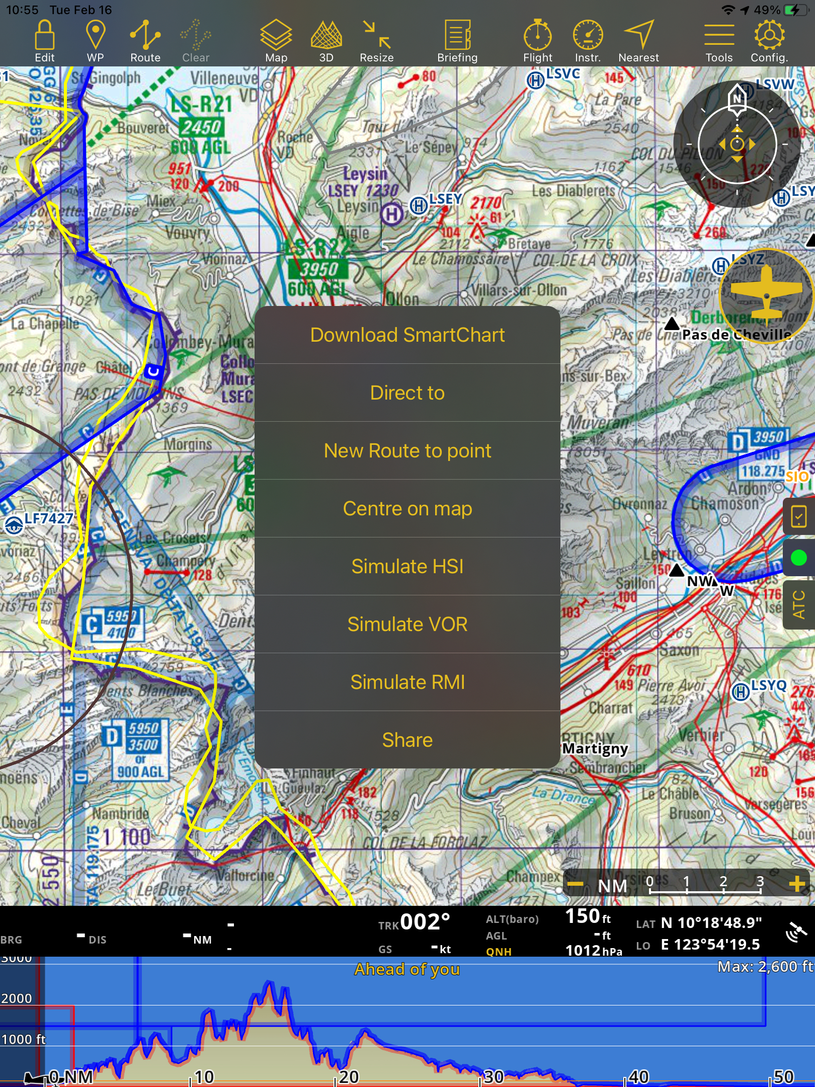
On the moving map, tap on any waypoint
On the pop-up window, tap the “…” at the upper right corner.
Select Download SmartChart
Select the radius of the waypoint you want to download.
Tap OK
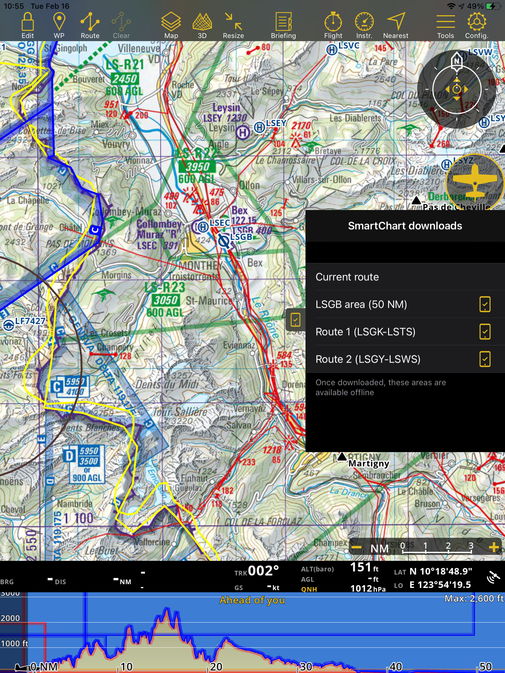
Example#
Waypoint LSGB - with radius 50 NM around the LSGB is added in the SmartChart downloads.
Update the waypoint radius in the Smartchart downloads#
On the drawers, tap the SmartChart downloads
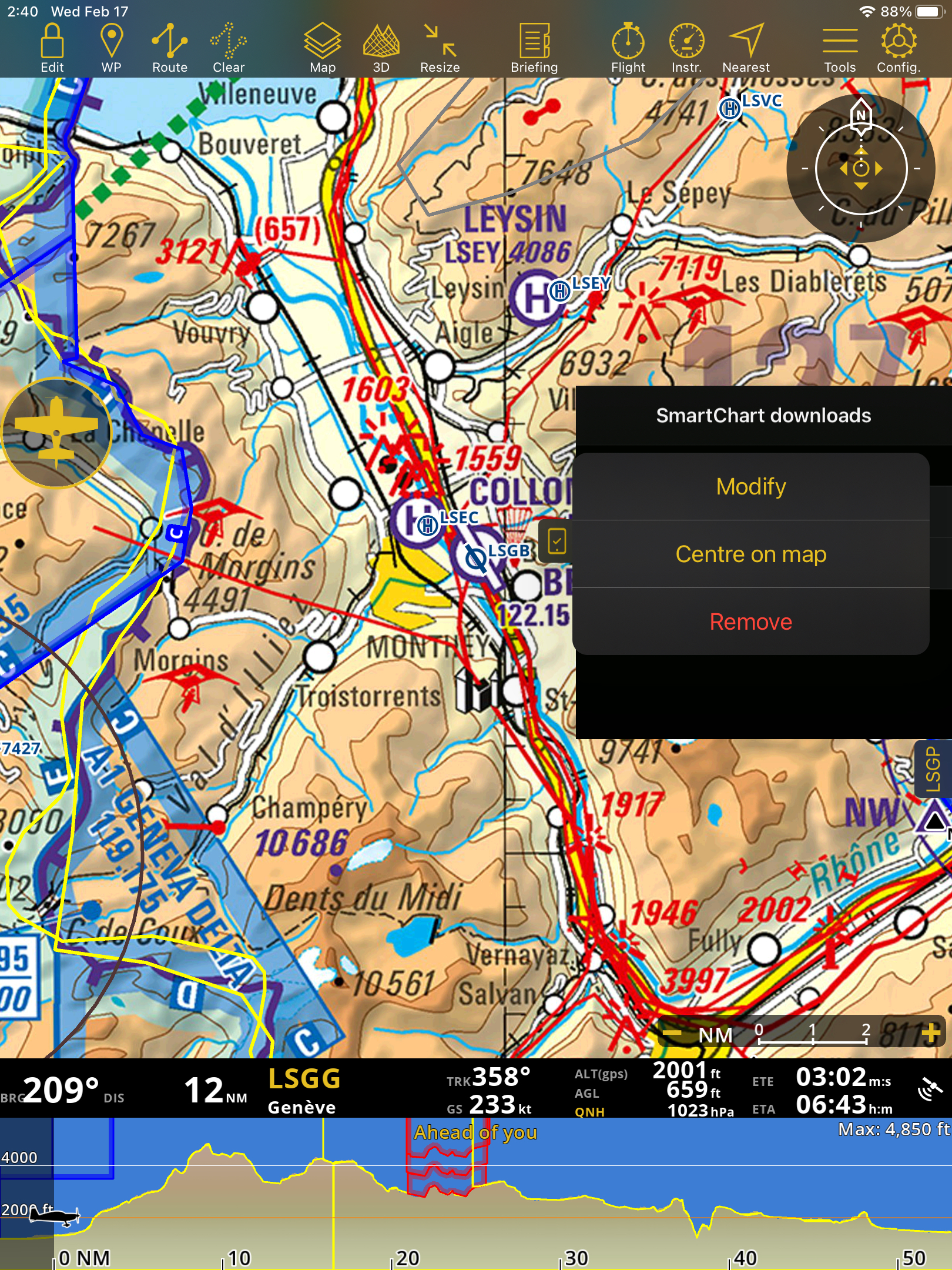
Select a waypoint to modify
Tap the interactive icon on the right side of the waypoint
Select Modify
Select a radius
Tap OK
Note
E.g. The settings for the Distance is “KM” and opens the Download SmartChart panel, the presets are in “KM”. When the user saves a distance, and changes the Distances setting to “NM”. Then opens again the Download Smartchart panel with the same waypoint, the presets are still in “KM”.
Remove a waypoint/route from the SmartChart downloads#
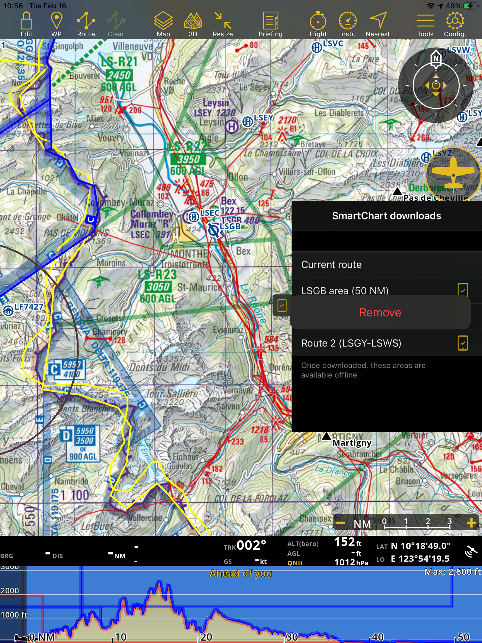
On the drawers, tap the SmartChart downloads
Tap the interactive button at the right side of the waypoint/route
Tap Remove.
Note
Deleting a route in the drawers will only delete it in the SmartChart downloads, it won’t delete it on your list of routes.
Resolution Centre#
The resolution centre displays a list of the issues detected in the app.
The colored dot icon on the drawers tab is an indicator of the following:
green - no issue detected
red - problem detected
amber - if nothing is done, an issue might happen.
Some errors you might find in the resolution centre:
GPS error
Barometer error
Low device storage space
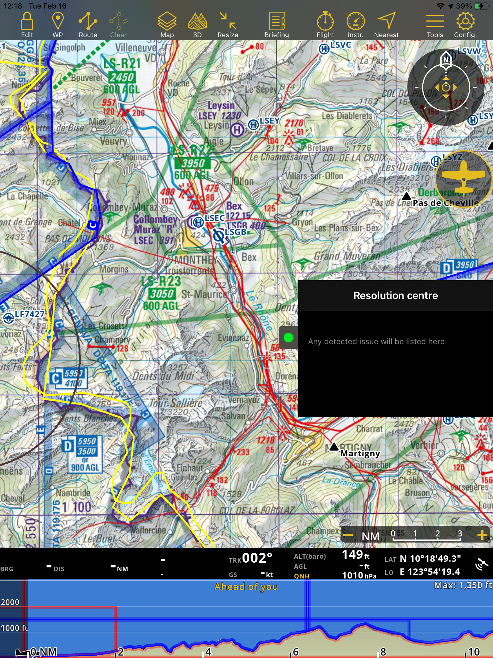
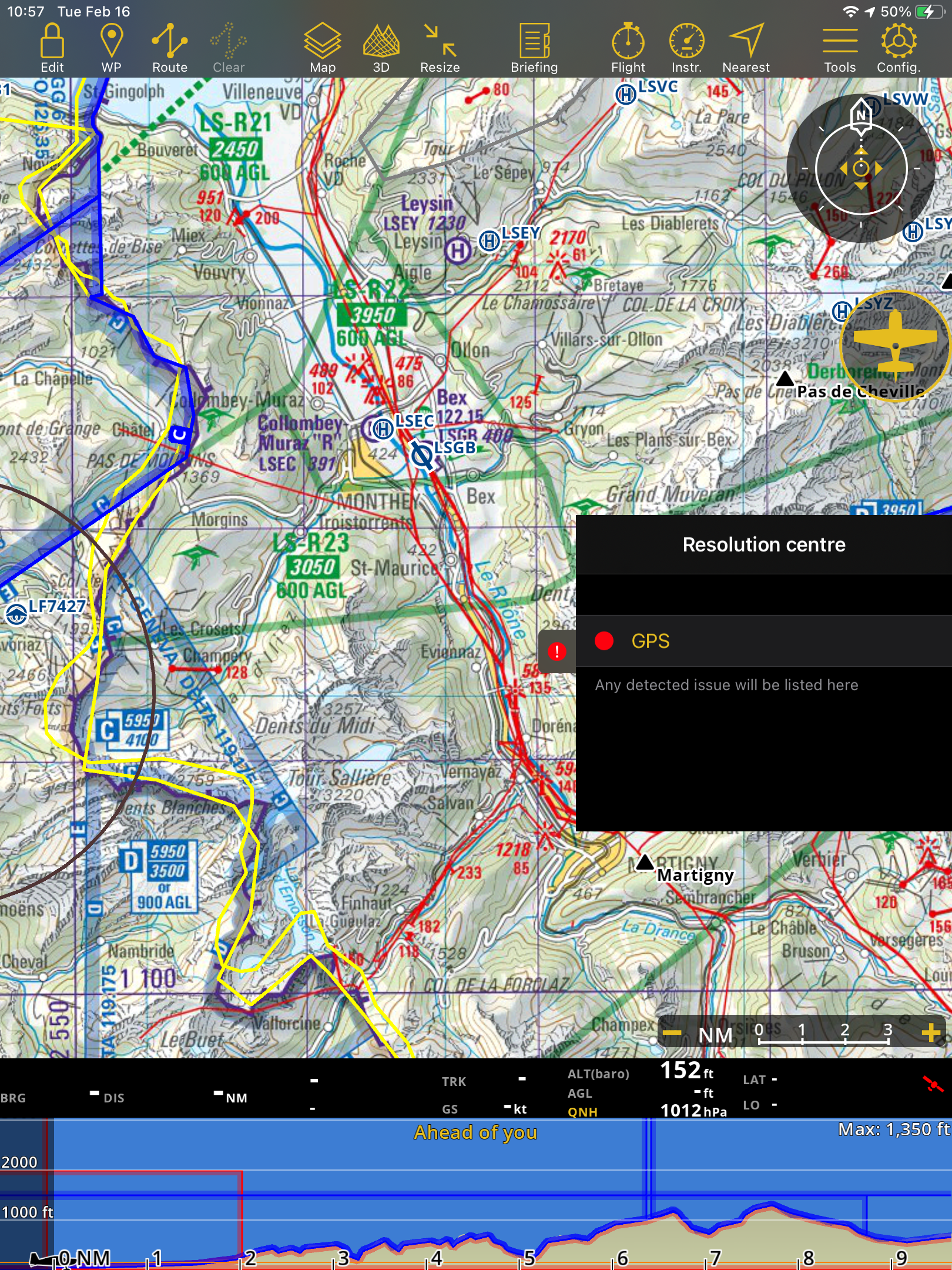
Examples: 1st image: no issue detected, and 2nd image: the GPS is not working properly.
ATC#
The ATC shows you an example of what you can tell ATC to report your status.
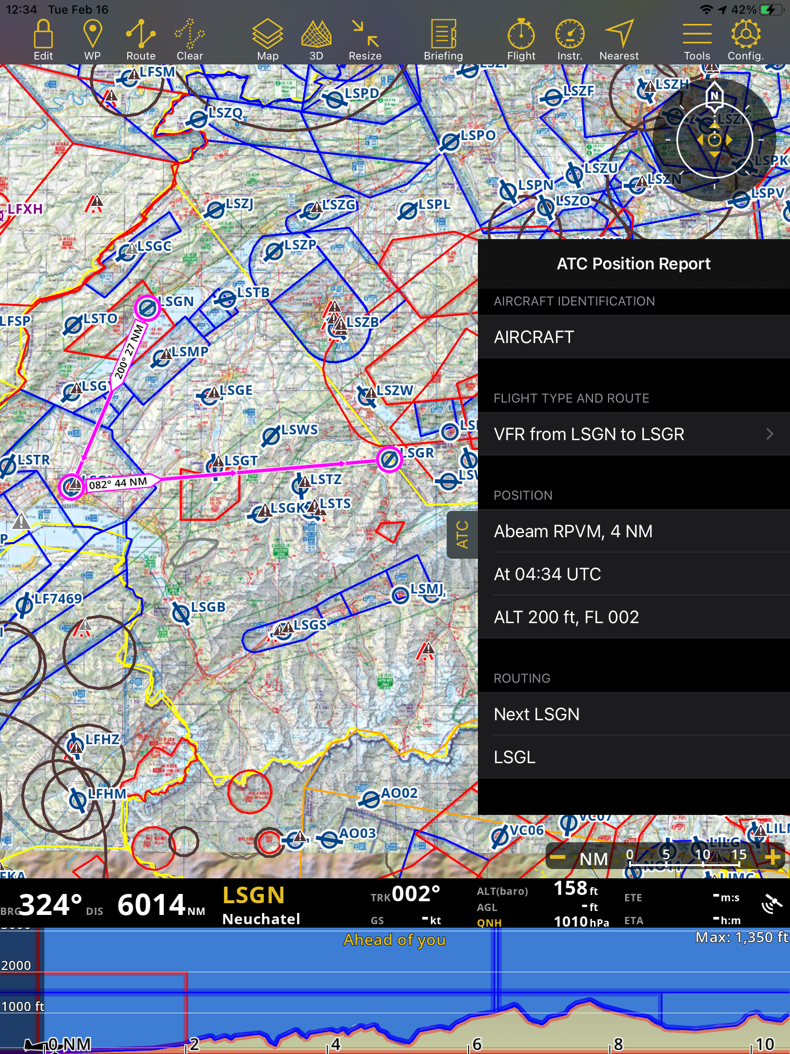
Note
ATC features only work on iPad and big iPhone screens like iPhone 6.
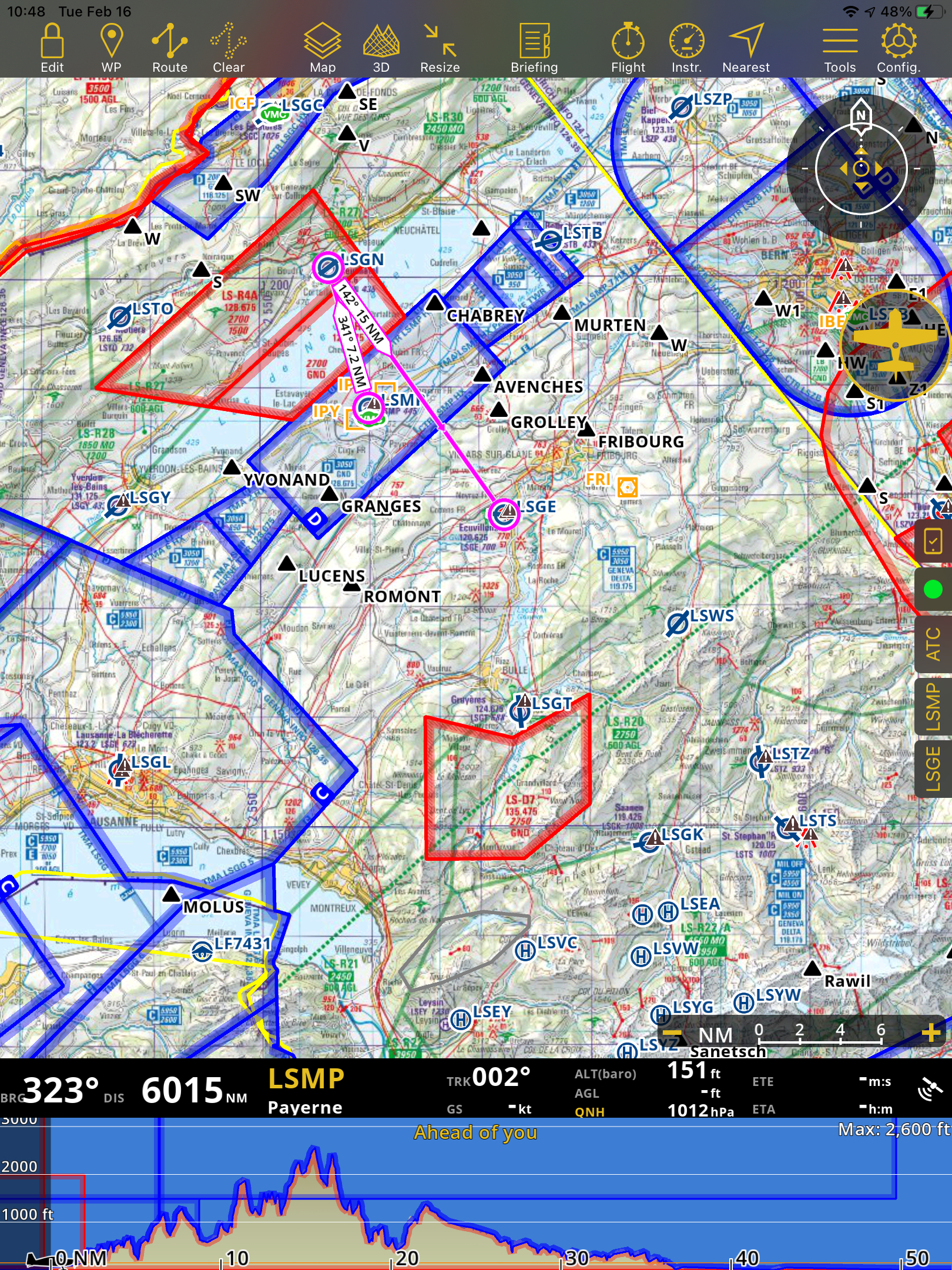
Departure and Arrival dock#
When a route has been created on the map, the Departure and Arrival drawers are shown.
Create a route on the moving map.
On the right side of the screen below the ATC, the identifier of the Departure waypoint and the identifier of the Arrival waypoint are displayed.
Tapping on the Departure/Arrival drawer to get further information about these waypoints
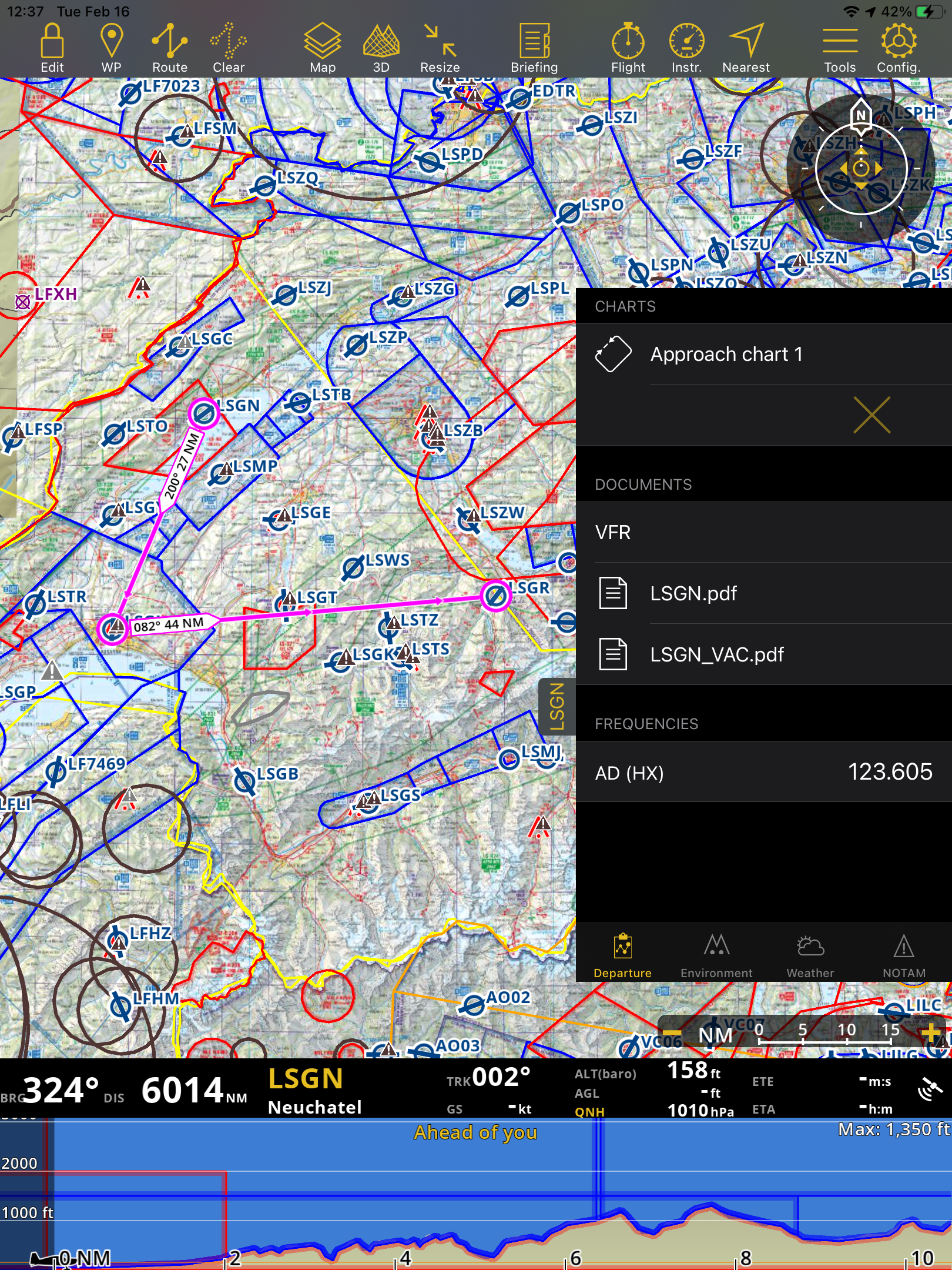
Departure / Arrival#
On this tab you will have access to the charts and documents related to the waypoint as well as its frequencies.
When tapping on a chart, it will be displayed on the moving map and tapping on the X mark will hide it.
Environment#
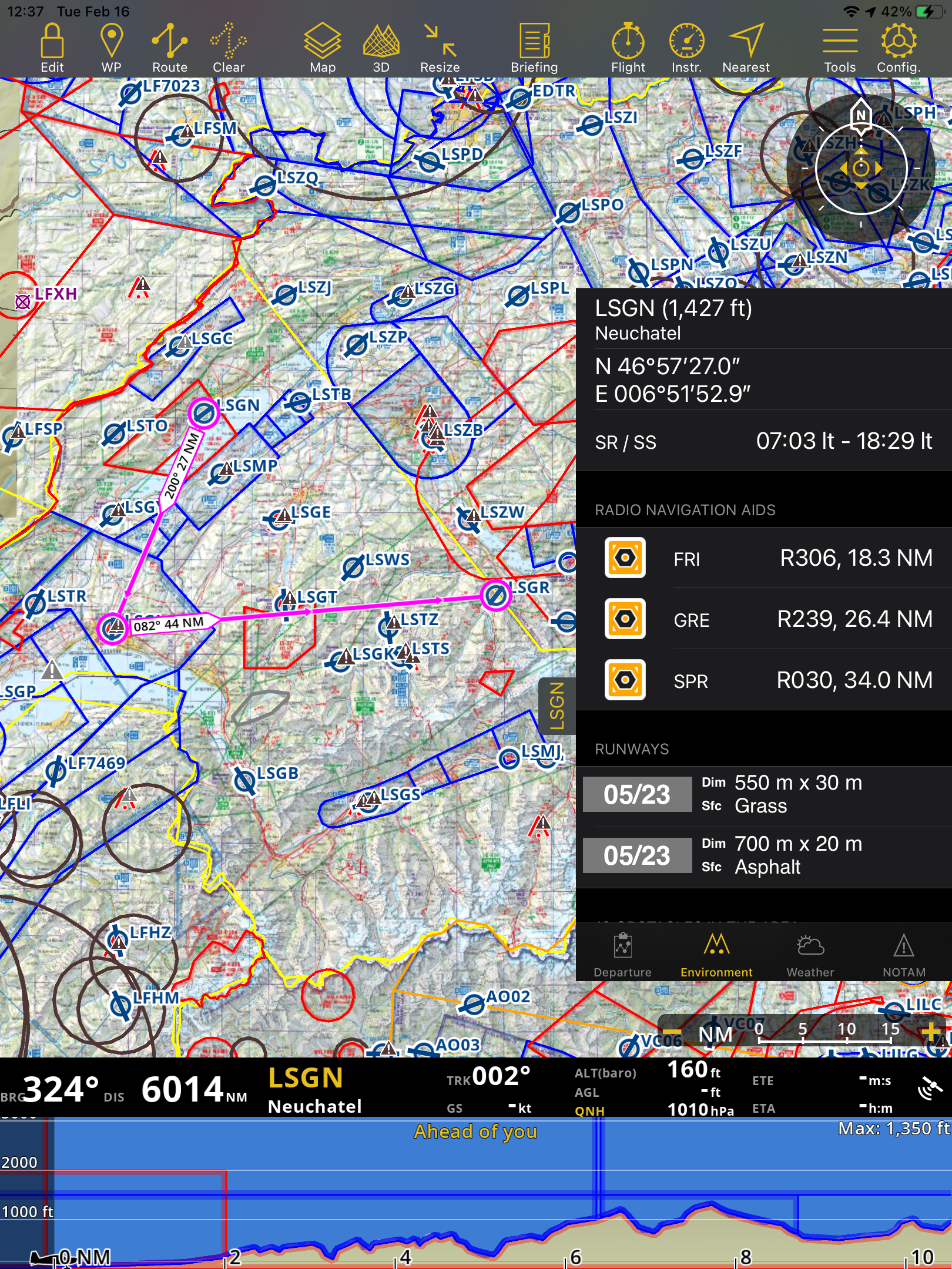
Show information about the location of the airfield and its surroundings: Height, Coordinates, Sunrise/Sunset time, Radio Navigation Aids (distance and radial), Runways, Obstacles*.
Weather#
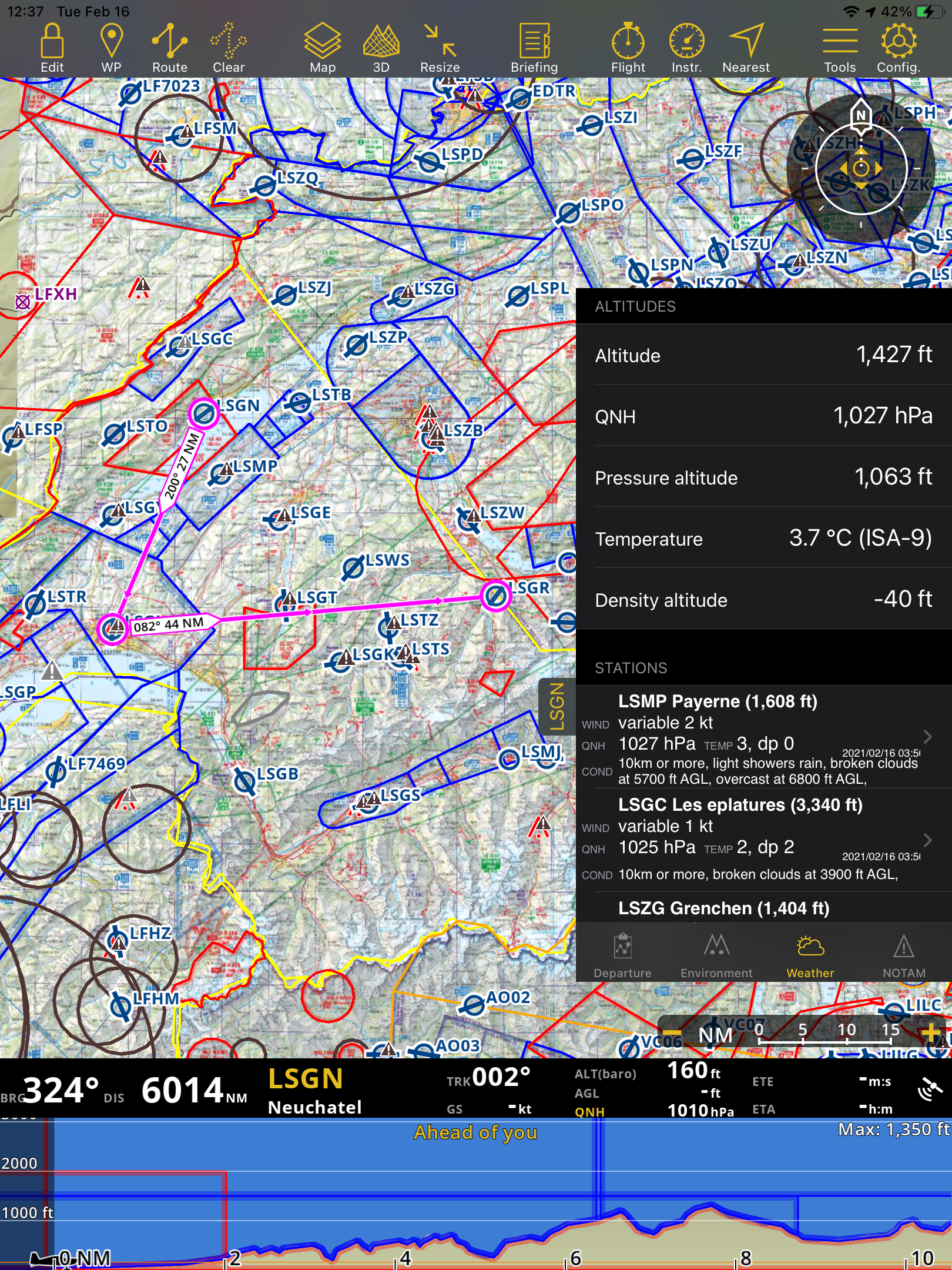
Gathers weather information from the weather stations next to the airfield. The app will calculate altitudes taking into account the current weather. It will show the METAR.
Tap on a station to see the report including the TAF.
NOTAM#
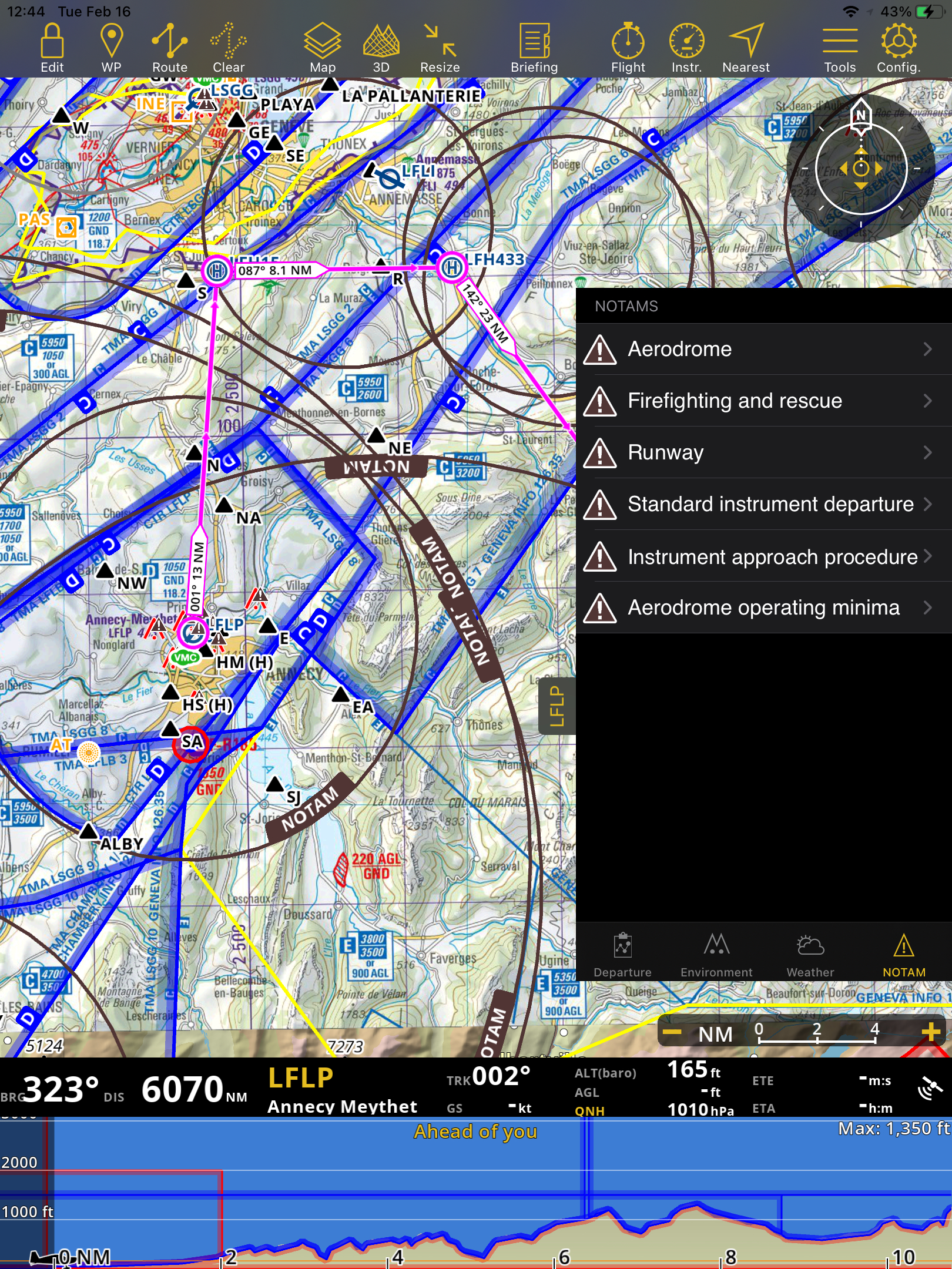
Nearby NOTAMs* of the waypoints will be shown in the list.
* Subscriptions to the mentioned services will be required in order for these functions to work (Approach Charts, Obstacles Database, Notam)