Our Features
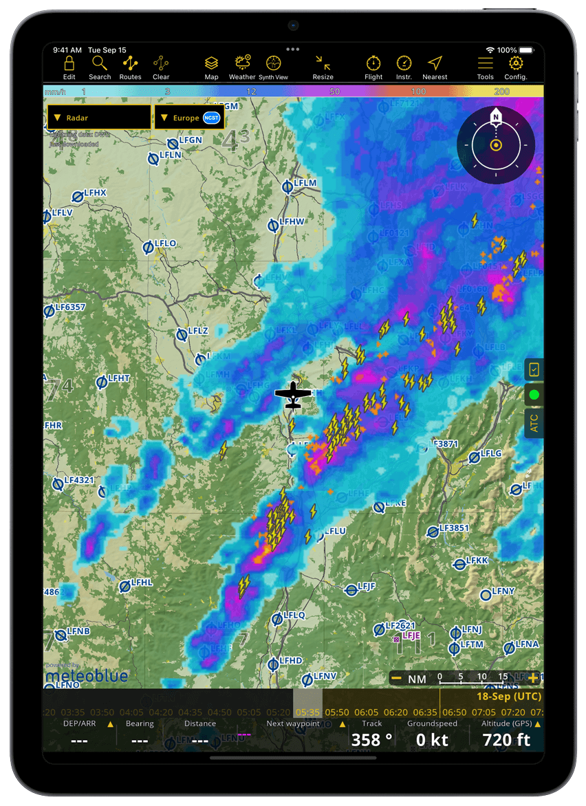
Advanced Weather Layers
- Displayed directly on the Moving Map with forecast data available up to 3 days ahead
- Included in all plans: Webcams and GAFOR forecasts for Switzerland, Germany, Austria, Balkans and Bulgaria
- Smart Advanced only: Rain Radar, Wind, Clouds and rain, Cloud base, Gusts, Ground Visibility and Pressure
- Continuously updated via the internet; forecasts remain accessible offline
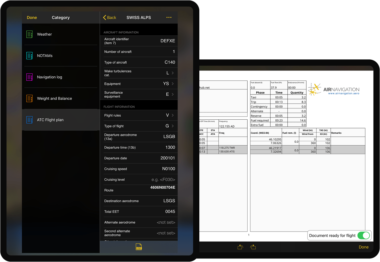
Flight planning
- Create a route in a few seconds directly on the interactive map or by entering one or more ICAO identifiers on the sidebar
- Review critical aeronautical and meteorological information related to your flight (NOTAM, METAR, TAF, Wind)
- Generate, print or share flight documents (Navigation plan, Weight and Balance, NOTAM briefing)
- Submit an ATC Flight Plan
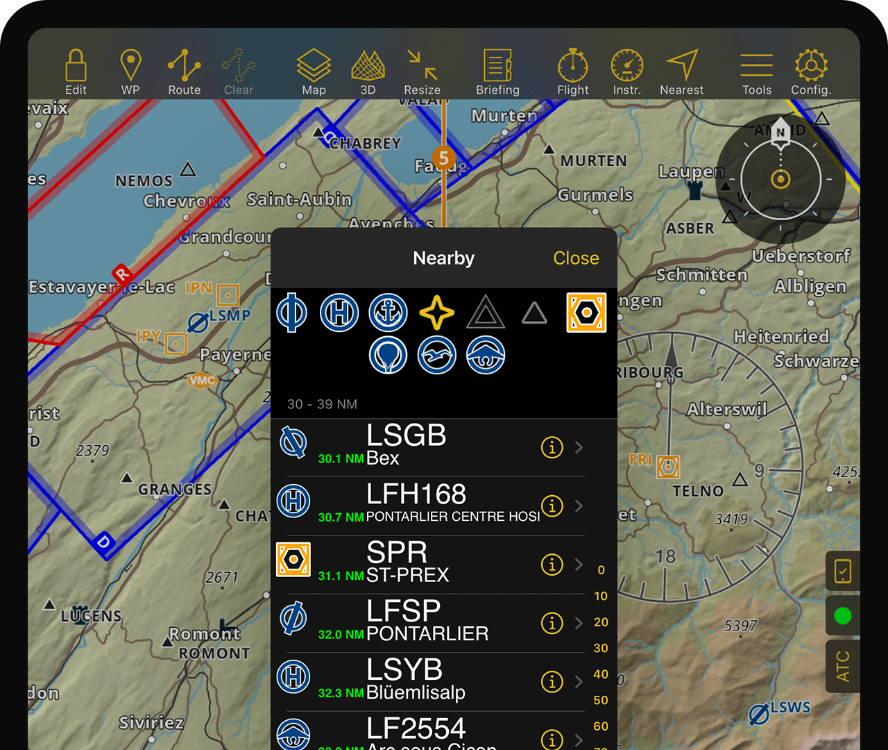
Interactive vector map
- Smartchart: Worldwide terrain, waypoints, airspaces, NOTAM, toponyms, road, cities, landmarks
- Disclose waypoints, airspaces, or NOTAM detailed information by a simple tap
- Obstacles for selected countries

Aeronautical charts
- Official ICAO raster chart for most European countries
- Sectional and World raster charts for the USA
- Third party aeronautical charts for Canada, South America, Russia, Australia and various other countries
- Topographic charts for various European countries
- Worldwide free ONC or OSM charts for countries having no other charts
Worldwide Aeronautical Database
- Comprehensive worldwide waypoints and airspaces database
- Database are updated every 28 days following the AIRAC cycle
- Obstacles database is updated weekly
- Worldwide Street and address database
Interactive NOTAMs
- NOTAMs are updated every 5 minutes
- NOTAMs detailed information can be disclosed by a simple tap on the map or by generating a route briefing
ATC Flight Plan
- Pre-filled with your selected aircraft information
- Can easily be submitted within the application
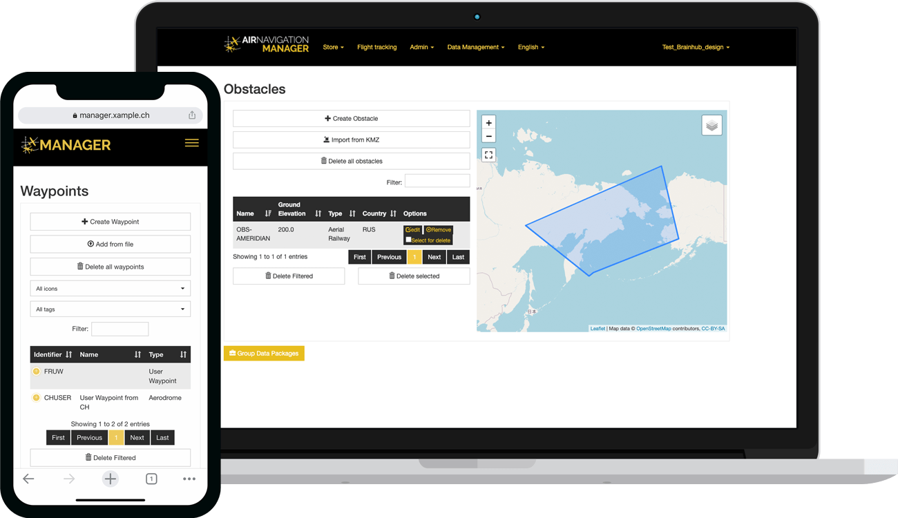
Manager functions
- For operators: manage a fleet of tablets by sharing and synchronizing company data with your pilots (need special business subscription)
Briefing
The interactive briefing menu allows you to prepare and generate documents relating your flight. Let the system quickly generate Weather & NOTAM briefings, Navigation Logs, W&B sheets or ATC flight plans. Documents can be stored and exported as PDF.
If you are a Standard or Premium subscriber you can directly submit your ATC flight plans to the Air Traffic Service from the app.
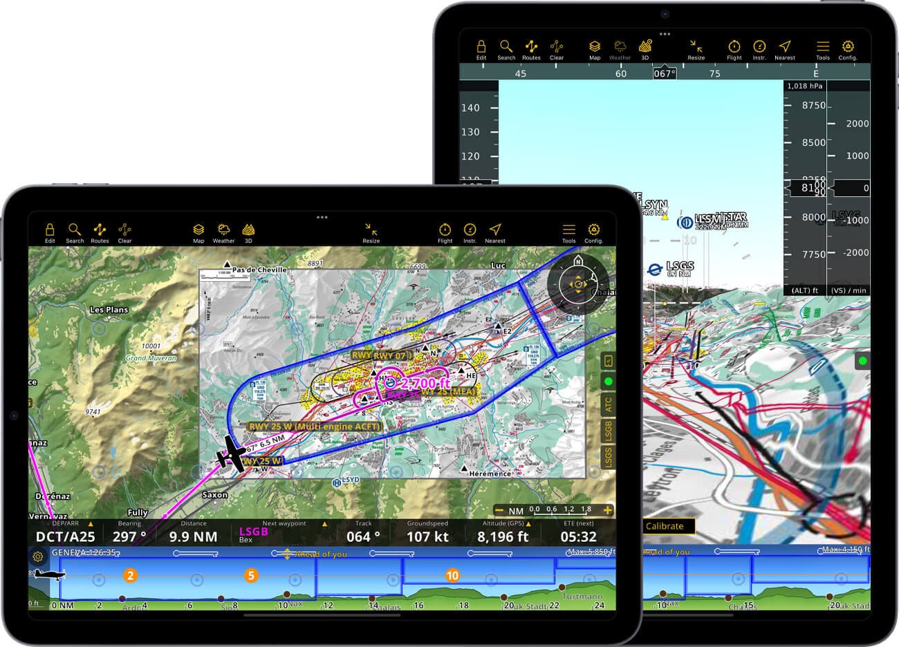
Moving Map
- North or course oriented, follows your current GPS position
- Follow your planned route on the moving map or by using leg values
- Avoid terrain hazard with the integrated TAWS and your current GPS or barometer reported altitude
- Real time navigation values (Speed, course, Bearing and ETE to next WP and many more)
- NOTAM and advisory messages from other pilots
- Other traffic
Approach charts
- Georeferenced airport approach charts automatically appear on departure and arrival aerodrome of your planned route
- AIP documents can be browsed for aerodrome of your choice
- Print AIP documents
Advanced Weather Layers
- Displayed directly on the Moving Map with forecast data available up to 3 days ahead
- Included in all plans: Webcams and GAFOR forecasts for Switzerland, Germany, Austria, Balkans and Bulgaria
- Smart Advanced only: Rain Radar, Wind, Clouds and rain, Cloud base, Gusts, Ground Visibility and Pressure
- Continuously updated via the internet; forecasts remain accessible offline
Elevation profile and TAWS
- Follow your vertical navigation on the terrain profile view
- Avoid restricted airspaces or terrain
- Look ahead or planned route modes
Night Mode
- The application UI is designed to be dark
- The moving map and elevation profile can be displayed with colors adjusted to accommodate a night flight
Traffic awareness
- Integrated Internet traffic thanks to our partnership with SafeSky *
- FLARM and ADS-B support **
- Visual and aural warnings
- ADS-L4Mobile support ***
* Included in all new Smart Subscriptions
** External hardware required
*** When using the integrated SafeSky traffic service, Air Navigation Pro uses an experimental version of ADS-L4Mobile to interface for bi-directional traffic exchange. Your position will be broadcasted to more than 15 systems to maximize visibility.
Scratchpad
- Conveniently reveal the note pad with 3 fingers swiping right to left
- Write briefings, frequencies and ATC instructions with your finger
- Hand notes are attached to the logbook for further review
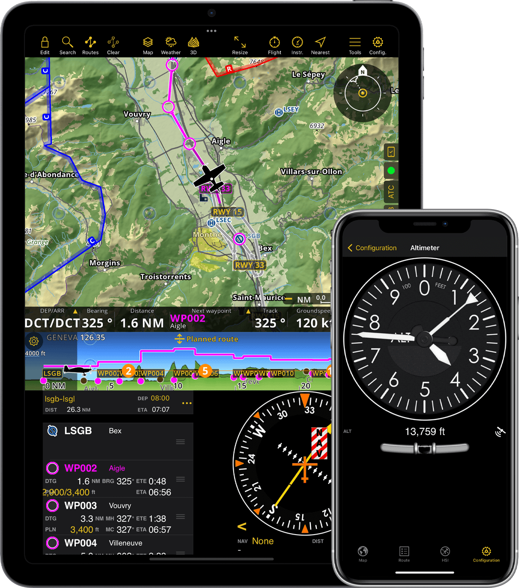
Instruments
- Navigate or train with various aircraft like instruments
- Put the HSI, RMI, Altimeter or any other instrument on the main screen
- Access any instrument at any time from the menu
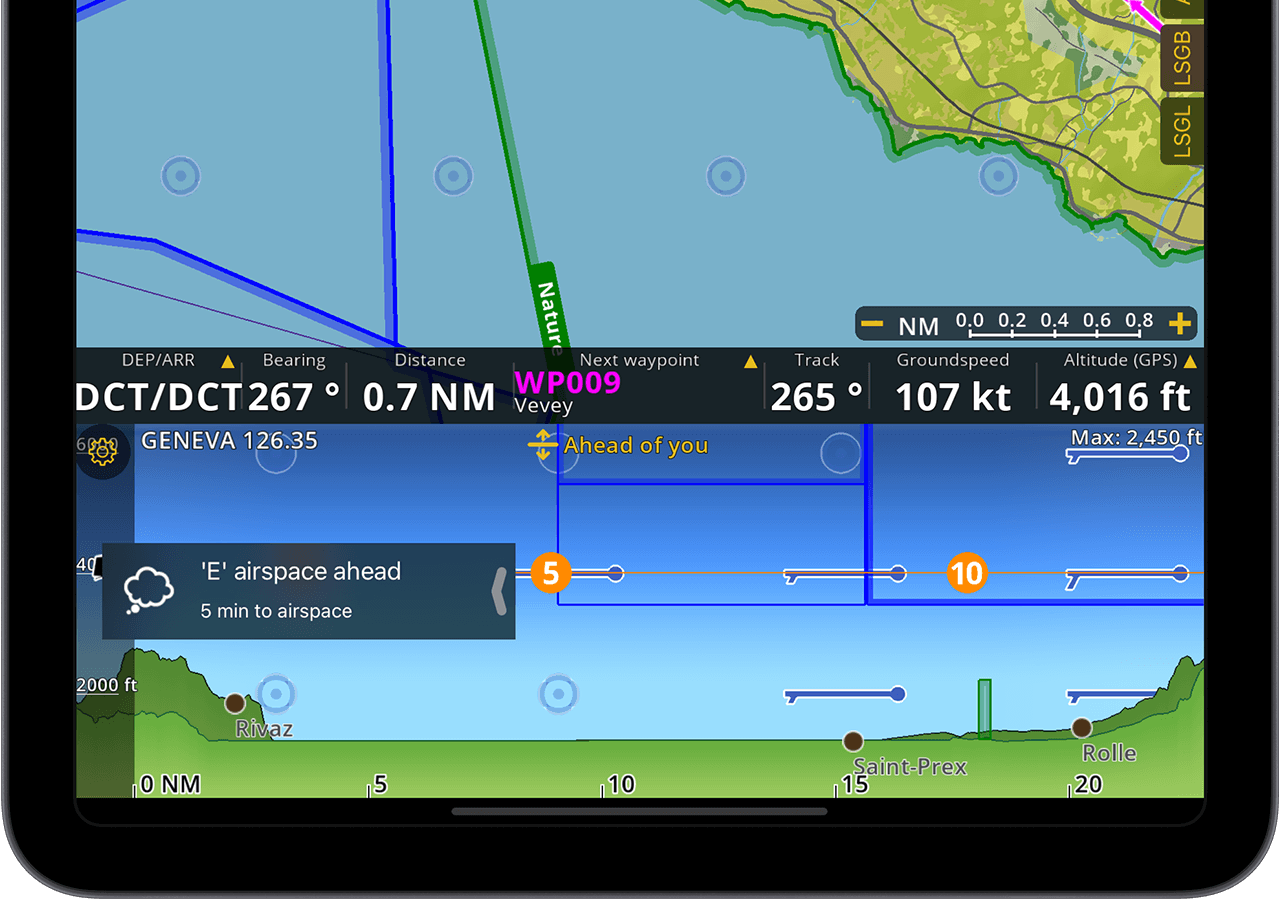
Alerts
- Air Navigation Pro can inform you when reaching airspaces
- User configurable alerts when leaving planned route or leaving or reaching flight level
- When a database update is available, an alert will inform you
Docks
- Direct access to airport information and documents related to your departure and arrival
- ATC drawer computes a position report message from your current GPS location and other flight parameters
- Status drawer will inform you on issues with the hardware sensors or configuration
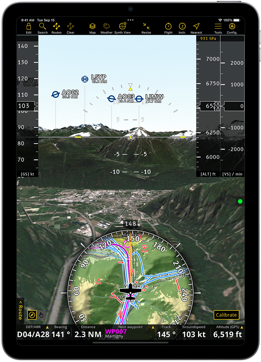
Synthetic View
- Synthetic vision with attitude from internal device gyroscopes and accelerometers
- Computer-generated 3D terrain model based on satellite photos
- Pan around to visualize locations before flying to them
- Equipped with an artificial horizon and a Moving Map preview, as well as altitude, ground speed and vertical speed indicators
- TAWS and approach charts overlay on top of the Synthetic View
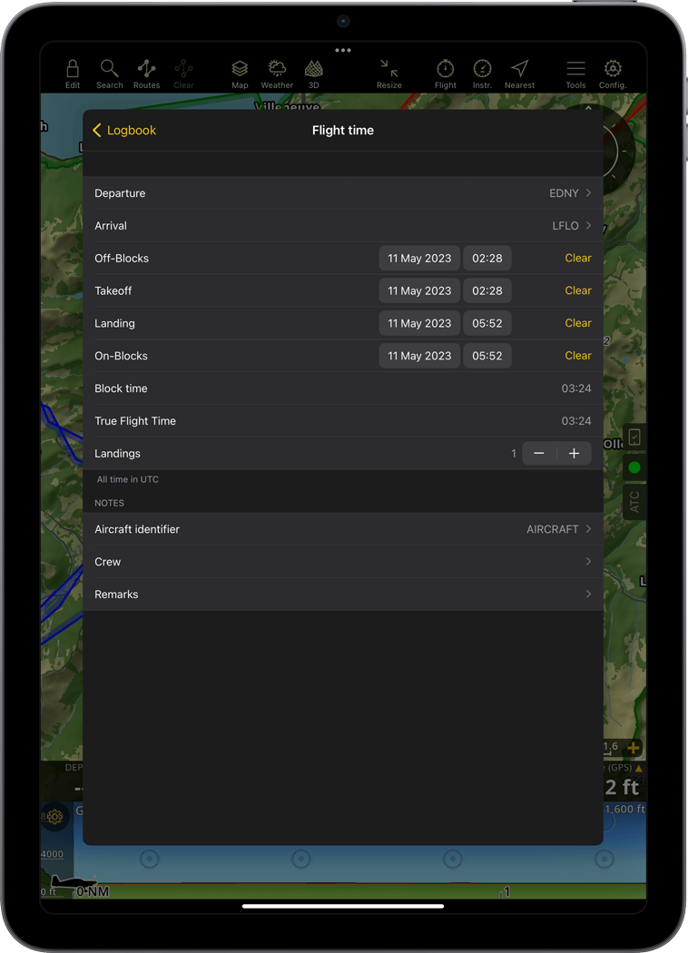
Automatic Logbook
- Block and Flight time, as well as departure and arrival airports are automatically recorded and save in the logbook
- Logbook can be edited to add missing flights or add comments
- Send the logbook to your email or computer
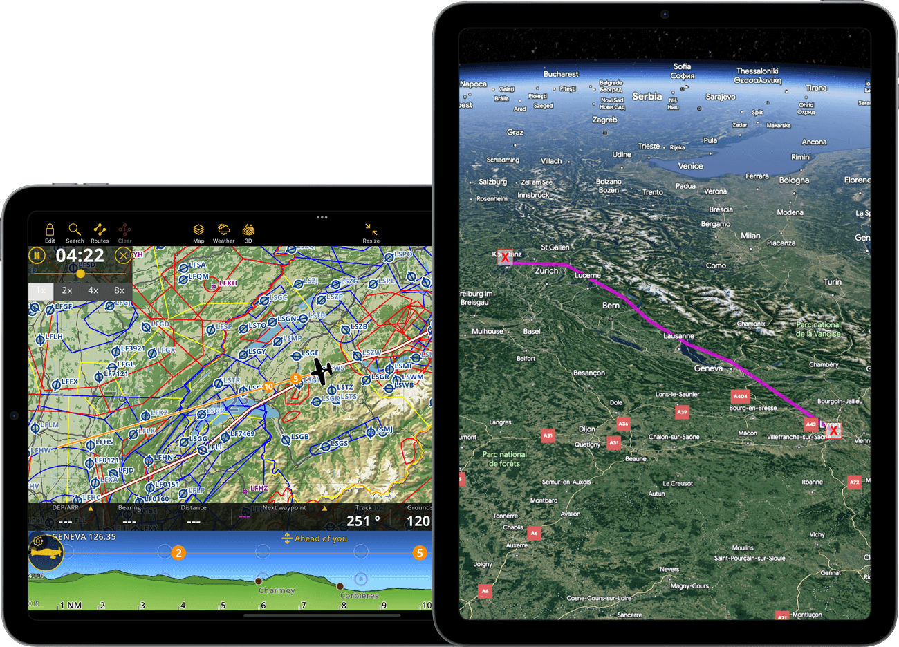
Flight Tracking
- Flights are recorded in a database
- Display the flight trace in real time with color coded speed and altitude changes
- Visualize a previous flight trace on the moving map
-
Share the flight in real time with your friends or family through the GSM network*
*Require a functional internet connection through GSM network.
Flight replay
- View the trace of a previous recorded flight
- Replay a flight
Flight sharing
- Share your recorded flights to your account or by email
- Export trace as KML or GPX files
Discover Air Navigation Pro for Free
Accessible across multiple platforms. Click on the store badge to begin your 28-day free trial today!